Services
Types Of Surveys We Provide
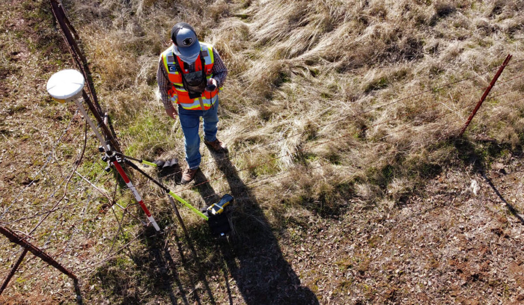
Boundary Line Retracement Surveying
Boundary line retracement surveying is for when you own an existing parcel of land, or are interested in purchasing a parcel of land, and don't know where the true boundary lines are, you would require the assistance of a licensed surveyor to locate and monument all corners or angle points that define that particular parcel of land.
Typically, property corners and angle points are marked with a 30" long, 5/8" rebar that has a plastic cap on top of it designating the name of the surveyor that placed the rod, and the surveyor's license number, such as "J.D.Barnes P.S. 8411". This cap would identify that Barnes Surveying set this property corner.
Other types of markers that have been used would include rocks with chiseled "X" in the top, rocks with drill doles in them, iron pipe, railroad spikes, Parker Kaylon nails (P.K. nails), even old axles from cars and trucks have been used to mark corners. Many old surveys even call out "witness trees" that mark the corner of the particular parcel being surveyed.
Lot Splits
Lot splits are for when you own a large parcel of land, and you wish to subdivide that parcel into many smaller parcels of land, usually to sell off those parcels, you would need a lot split survey.
The surveyor would survey the land to know exactly how much land is available to be split, then he would apply local zoning ordinances, city, county, and state laws that apply, to determine the size and number of lots that can be legally created. Then he would write a deed for each individual parcel, and draw a plat map showing all the parcels to be created.
After that, the surveyor would deliver the deeds and the plat map to the respective offices in the jurisdictional area for approval. Once approval has been granted, then the surveyor would hand over the deeds and the plat map to the owner for recording in the county recorder’s office.
Mortgage Location Surveying
A mortgage location survey is usually required by a mortgage company providing the loan on a particular piece of property. If the mortgage company representative has paid a visit to the property, and has suspicions that there may be an encroachment of a building, outbuilding, landscape, trees, etc., that may be too close to the property line, or if it is actually over the property line, on the adjoining parcel, then the mortgage company will hire a surveyor to survey the property, and locate every structure, outbuilding, landscape, trees, utilities, etc., to show their location associated with the property lines.
This protects the mortgage company from loaning money on a building, etc. that may not be completely on the parcel of land that it claims to be on.

Flood Elevation Certificates
A mortgage company will require that a property owner have flood insurance on any parcel that has an insurable structure on the property that lies within a designated flood zone as shown on the FEMA flood zone maps.
A flood elevation certificate is a document filled out by a licensed surveyor stating that the elevation of the insurable property is above the 100 year flood zone level, meaning that the structure is unlikely to be damaged by flooding waters.
Once the mortgage company receives the flood elevation certificate from the homeowner showing that the insurable property is above the 100 year flood elevation, then the mortgage company will drop the requirement that the homeowner must provide flood insurance on the property. This only means that the homeowner isn't required by the mortgage company to have flood insurance anymore. The homeowner may still provide flood insurance on their property if they so choose to.Construction Layout And Staking
We perform a wide variety of services such as site grading, set backs, staking offsets for building corners, establishing line and grade for underground utilities, establishing benchmarks for the site, final grading checks, and much more. We can handle most any need of the general contractor.
ALTA/ACSM Surveys
Usually required when purchasing commercial property, an ALTA/ACSM survey is much more in depth than the average boundary survey. Without going in to great detail, use this link https://www.alta.org/policy-forms/download.cfm?formID=483&type=word to help understand what all is entailed in doing an ALTA/ACSM survey.
Easement Surveys
Easements are given to allow a specific limited use or enjoyment of someone else’s property without giving up ownership of the property. Usually, they are for utilities, a road, a drainage ditch or just to walk across another persons property. They must be surveyed and have a legal description prepared by a licensed surveyor. They must be recorded in that counties recorder’s office before the transferring of rights to another person to cross the property is considered legal.
Topographic Surveys
When a land owner wants to know the lay natural and man-made features of his/her property, or how the rain water will drain from his/her property, he/she will request a topographic survey of their property.
This type of survey will show contour lines (elevation lines) across the parcel, allowing someone to make intelligent decisions about where to place proposed building, or how to handle rain water runoff so as to not be adversely affected by mother nature.
Property Corner Location Service
When a land owner wants to know where the property corners are of their existing parcel, or of a parcel they are looking to purchase, they would ask a surveyor to "locate the property corners" first.
Surveyors use a special type of metal locating device that only picks up ferrous metals, such as iron and steel, which are usually what is set to delineate the property corners. These metal locators ignore all other types of metals, greatly enhancing the ability to find only the property corners, and not every piece of metal on the property.
If the property corners are locatable, then the surveyor will drive a 48" wooden lath next to the corner pins, and put flagging on the top of the lath to aid the property owner in finding the corners after the surveyor leaves.
But, if one or more of the property corners cannot be located, then the property owner has the right to request to have a boundary line retracement survey performed to establish the location of the missing corners.
The property corner location service is much cheaper than a boundary line retracement service, so be advised that you will probably ask for the property corner location survey first, then if one or more of the property corners cannot be found, the owner can request the more expensive boundary line retracement survey to establish the missing corner(s).

